Monmouthshire
From WhereToday
Q1245075
Q1245075
Monmouthshire, also formerly known as the County of Monmouth, was one of the thirteen counties of Wales that existed from 1536 until their abolition in 1974. Located in the south-east of Wales, on the border with England, its area now corresponds approximately to the present principal areas of Monmouthshire, Blaenau Gwent, Newport and Torfaen, and those parts of Caerphilly and Cardiff east of the Rhymney River.

 Hand-drawn map of Monmouthshire by Christopher Saxton from 1577
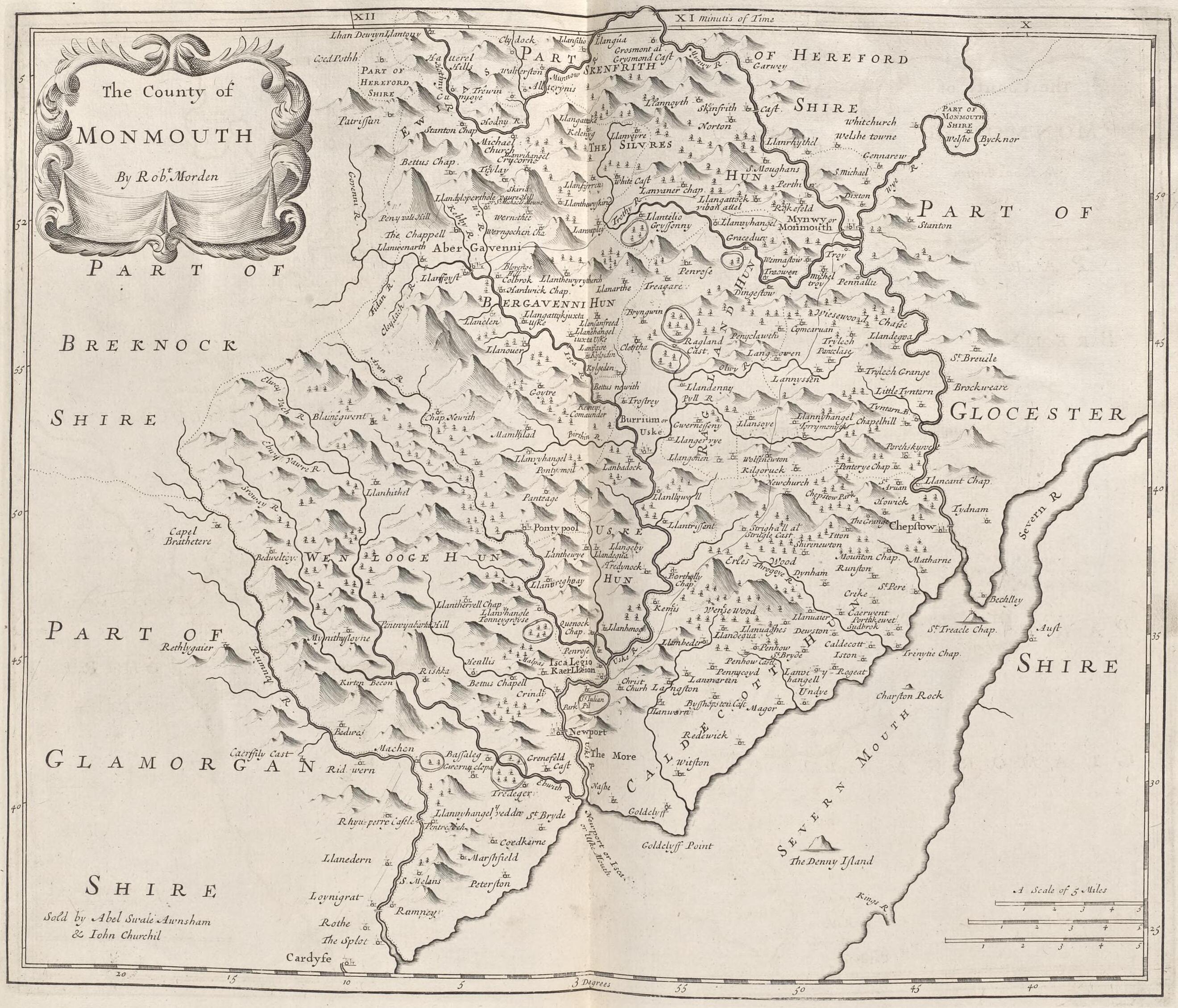 Monmouthshire: Robert Morden (1695)
- An historical tour in Monmouthshire - book by William Coxe (1801), English
- The last days of the chantries and shrines of Monmouthshire - scientific article published in 1991, online
- THE 1868 GENERAL ELECTION IN MONMOUTHSHIRE - journal article, 2002
- William Coxe, Thomas Morrice and the Castles of Monmouthshire - scientific article published in December 2019
| Type | Subtype | Date | Description | Notes | Source |
|---|---|---|---|---|---|
| commons | image | Hand-drawn map of Monmouthshire by Christopher Saxton from 1577 | Commons | ||
| commons | image | Monmouthshire: Robert Morden (1695) | Commons | ||