Q67574558: Difference between revisions
From WhereToday
Q67574558
Bot: Automated import of articles *** existing text overwritten *** |
Bot: Automated import of articles *** existing text overwritten *** |
||
| Line 1: | Line 1: | ||
{{ | {{Page|Staffordshire|Areas|historic county of England|}} | ||
Latest revision as of 20:52, 1 September 2025
historic county of England

 Ornamental pots around 1872. - Budapest Museum of Applied Arts
 Hand-drawn map of Staffordshire from 1577
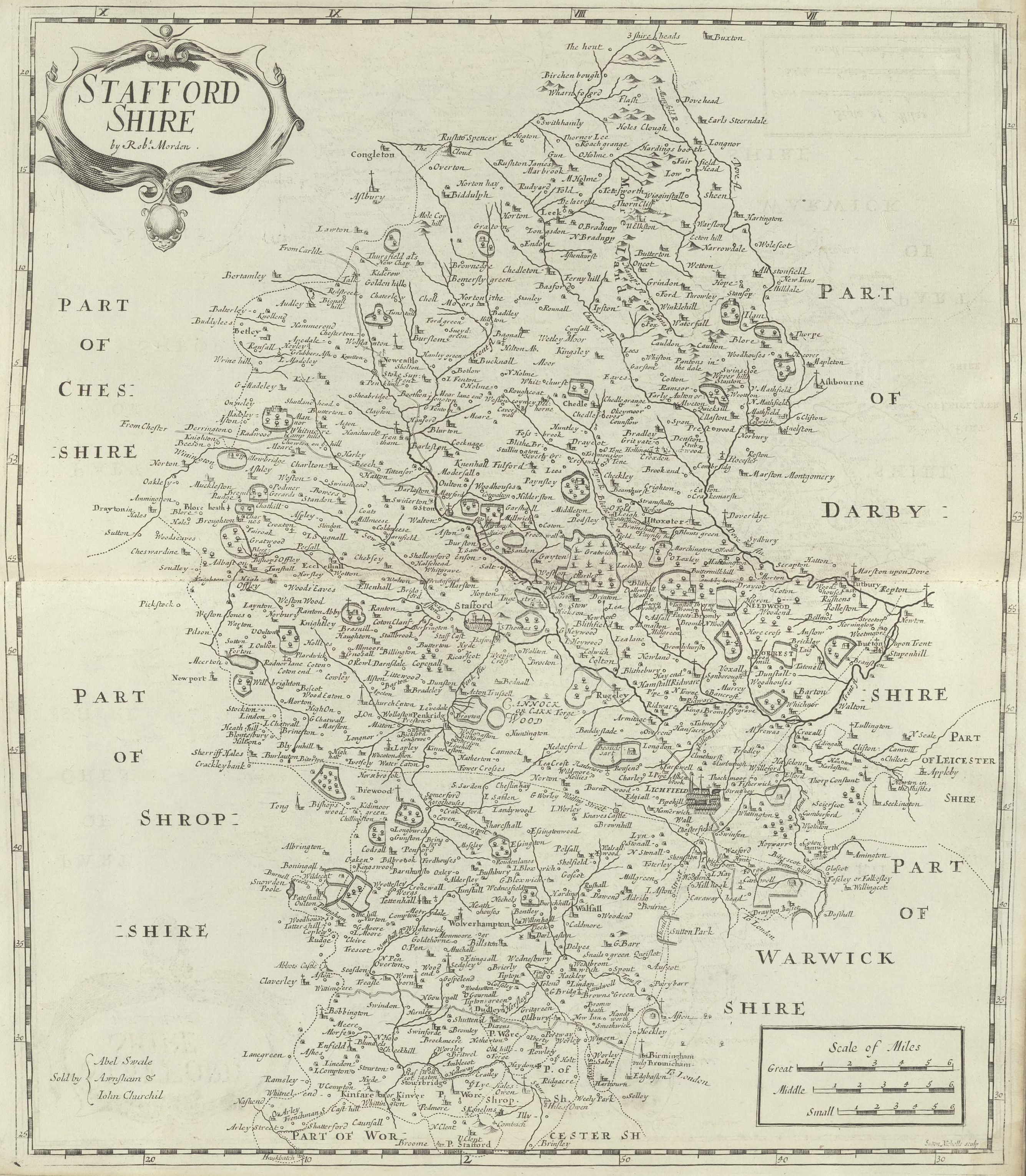 Staffordshire: Robert Morden (1695)
 Cockle Lucas Johnson
 Dumkins Farm Interior Taken 1978
 Interior Dumkins Farm Taken Winter 1978
 Steam roller line up, Klondyke Mill
 Dimmingsdale Pumping Station
 Truncated chimney, Clay Mills Pumping Station
 Growing on the vine - Halfpenny Green Vineyard
- map of Staffordshire - printer's proof of map by Christopher Saxton from Lord Burghley's Atlas, English, 1579, online
- Saxton's map of Staffordshire, publication state - 1579 edition of map by Christopher Saxton, English, online
- map of Staffordshire - printer's proof of map by Christopher Saxton from Lord Burghley's Atlas, Latin, 1579, online
- Saxton's map of Staffordshire, publication state - 1579 edition of map by Christopher Saxton, Latin, online
- Saxton's map of Staffordshire, pre-publication proof state - edition of map by Christopher Saxton, English, 2017, online
- Saxton's map of Staffordshire - map drawn by Christopher Saxton, English, 1579
- Saxton's map of Staffordshire - map drawn by Christopher Saxton, Latin, 1579
- Newspapers and numismatics: forgotten medieval and Tudor coin finds from West Midlands periodicals, 1786-1905 - scholarly article published in 2017, 1975
- Saxton's map of Staffordshire - map drawn by Christopher Saxton, English
- Anonymous 1602-3 series Maps C.2.cc.2.(2-4, 9-11, 19-24.) - collection of maps in the British Library
- Anonymous 1602-3 series Maps C.2.cc.2.(2-4, 9-11, 19-24.) - collection of maps in the British Library
- Anonymous Maps State II - series of maps printed in London by Peter Stent (ca. 1650)
- Saxton's map of Staffordshire - map drawn by Christopher Saxton, Latin
- Anonymous Maps State III - series of maps printed in London by John Overton (ca. 1670)
- Anonymous Maps State II - series of maps printed in London by Peter Stent (ca. 1650)
- Anonymous Maps State III - series of maps printed in London by John Overton (ca. 1670)
- Anonymous Maps - series of 12 unsigned maps of English counties ca. 1602-03 now attributed to William Smith and Jodocus Hondius
- Anonymous Maps - series of 12 unsigned maps of English counties ca. 1602-03 now attributed to William Smith and Jodocus Hondius
- map of Staffordshire - printer's proof of map by Christopher Saxton from Lord Burghley's Atlas, English
- Saxton's map of Staffordshire, pre-publication proof state - edition of map by Christopher Saxton, Latin
- Soils in Staffordshire II: Sheet SJ82 (Eccleshill) - 1975 publication
- Staffordshire Victoria County History - county history series, part of Victoria County History, English
- map of Staffordshire - printer's proof of map by Christopher Saxton from Lord Burghley's Atlas, Latin
| Type | Subtype | Date | Description | Notes | Source |
|---|---|---|---|---|---|
| commons | image | Ornamental pots around 1872. - Budapest Museum of Applied Arts | Commons | ||
| commons | image | Hand-drawn map of Staffordshire from 1577 | Commons | ||
| commons | image | Staffordshire: Robert Morden (1695) | Commons | ||
| commons | image | Cockle Lucas Johnson | Commons | ||
| commons | image | Dumkins Farm Interior Taken 1978 | Commons | ||
| commons | image | Interior Dumkins Farm Taken Winter 1978 | Commons | ||
| commons | image | Steam roller line up, Klondyke Mill | Commons | ||
| commons | image | Dimmingsdale Pumping Station | Commons | ||
| commons | image | Truncated chimney, Clay Mills Pumping Station | Commons | ||
| commons | image | Growing on the vine - Halfpenny Green Vineyard | Commons | ||