Fort Beauséjour
From WhereToday
Q844533
Fort Beauséjour, renamed Fort Cumberland in 1755, is a large, five-bastioned fort on the Isthmus of Chignecto in eastern Canada, a neck of land connecting the present-day province of New Brunswick with that of Nova Scotia. The site was strategically important in Acadia, a French colony that included primarily the Maritimes, the eastern part of Quebec, and northern Maine of the later United States. The fort was built by the French from 1751 to 1752. They surrendered it to the British in 1755 after their defeat in the Battle of Fort Beauséjour, during the Seven Years' War. The British renamed the structure as Fort Cumberland. The fort was strategically important throughout the Anglo-French rivalry of 1749–63, known as the French and Indian Wars by British colonists. Less than a generation later, it was the site of the 1776 Battle of Fort Cumberland, when the British forces repulsed sympathisers of the American Revolution.
1751
Wikimedia, Wikidata
Fort Beausejour
Canada, 
-
Location: 45.8646, -64.2916, KML, Cluster Map, Maps,
 Map of the western part of the Chignecto Isthmus showing Beauséjour Fort and the surrounding areaMap of the western part of the Chignecto Isthmus showing Beauséjour Fort and the surrounding area
 FortBeausejour1755byCaptHamiltonFortBeausejour1755byCaptHamilton
 Le Tour du monde, nouvelle série-06-p543
 Closed for the season
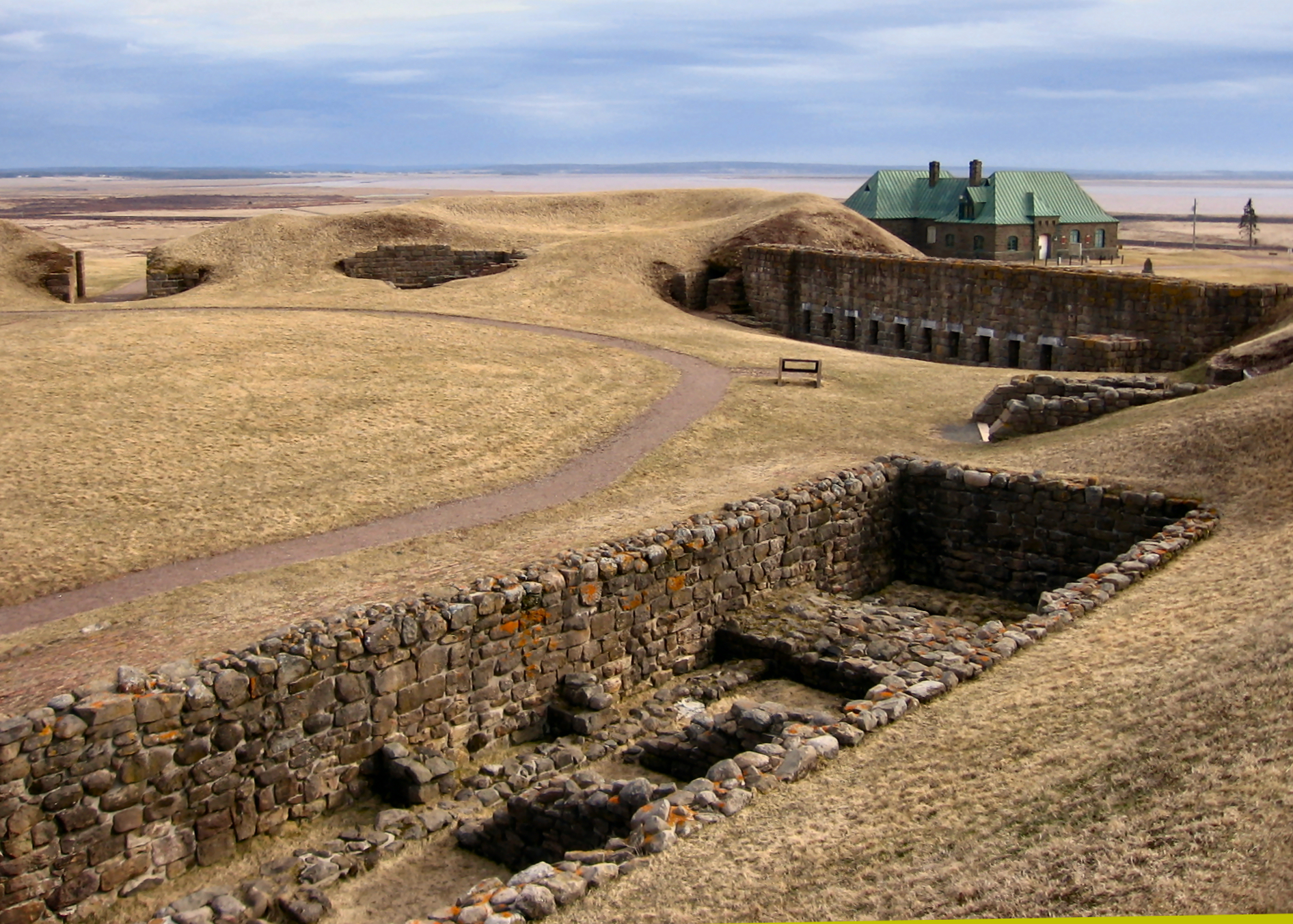 Beausejour2006Beausejour2006
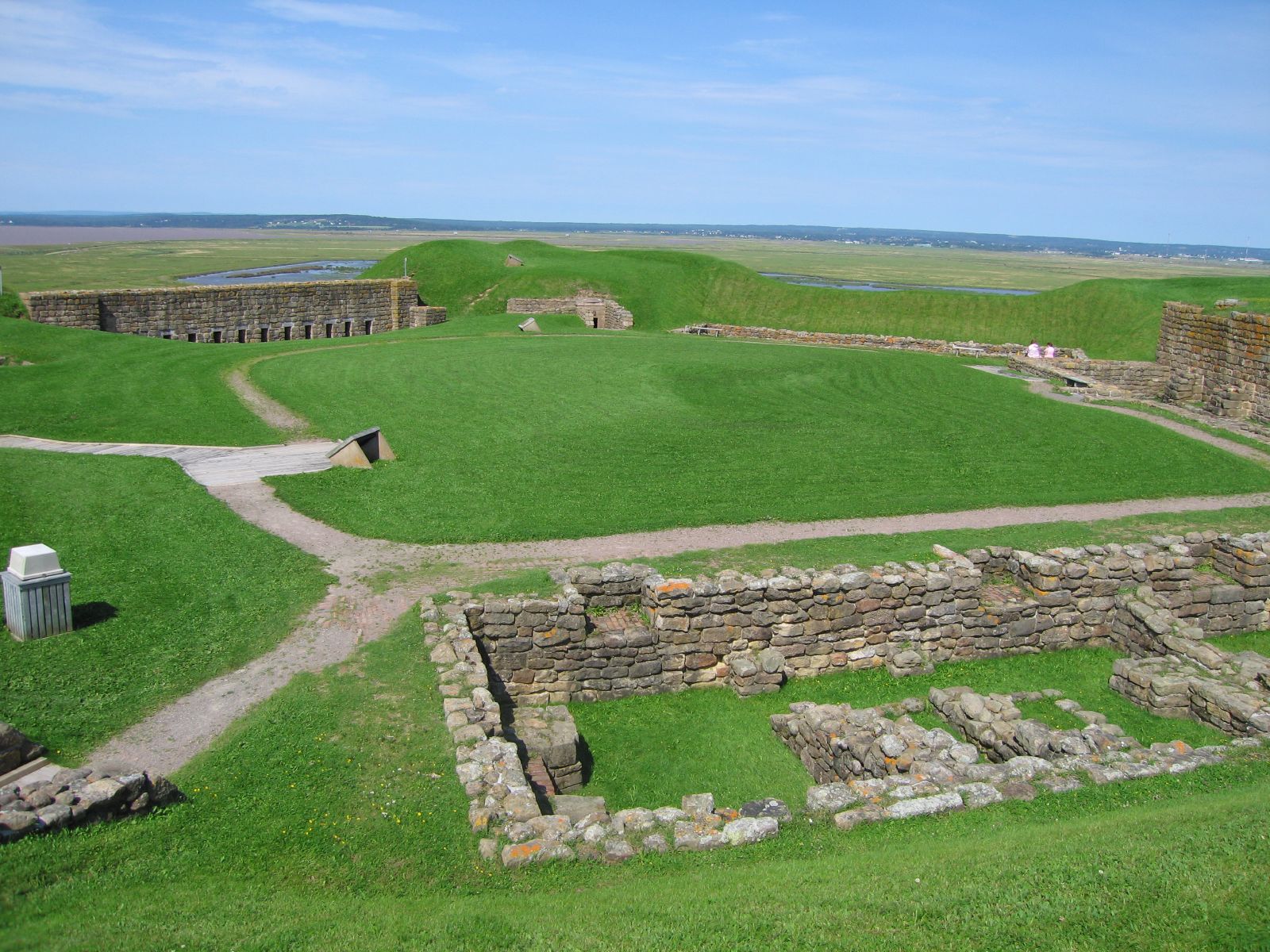 The Maritimes130 - Flickr - GregTheBusker
 The Maritimes136 - Flickr - GregTheBusker
| Type | Subtype | Date | Description | Notes | Source |
|---|---|---|---|---|---|
| commons | image | Map of the western part of the Chignecto Isthmus showing Beauséjour Fort and the surrounding area | Commons | ||
| commons | image | Map of the western part of the Chignecto Isthmus showing Beauséjour Fort and the surrounding area | Commons | ||
| commons | image | FortBeausejour1755byCaptHamilton | Commons | ||
| commons | image | FortBeausejour1755byCaptHamilton | Commons | ||
| commons | image | Le Tour du monde, nouvelle série-06-p543 | Commons | ||
| commons | image | Closed for the season | Commons | ||
| commons | image | Beausejour2006 | Commons | ||
| commons | image | Beausejour2006 | Commons | ||
| commons | image | The Maritimes130 - Flickr - GregTheBusker | Commons | ||
| commons | image | The Maritimes136 - Flickr - GregTheBusker | Commons | ||