Suffolk
From WhereToday
historic county of England

 The front cover for my picture book The Baker by the Sea
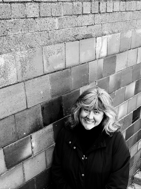 A portrait of Paula White Illustration the author and illustrator of The Baker by the Sea
 Hand-drawn map of Suffolk from 1573
 Moated site and associated garden immediately east of The Hall
 Suffolk: Robert Morden (1695)
 Frederick George Cotman – An Ancient Fort in Suffolk
 Steam powered hydraulic pump
 Storey Bros, Cattawade - power house
 Storey Bros Cattawade - boiler house
 Brent Geese (Branta bernicla) on the Deben Estuary
- Saxton's map of Suffolk, publication state - 1579 edition of map by Christopher Saxton, English, online
- Suffolk Victoria County History - county history series, part of Victoria County History, English, 1579, online
- Saxton's map of Suffolk - map drawn by Christopher Saxton, English, 1579, online
- Saxton's map of Suffolk, pre-publication proof state - edition of map by Christopher Saxton, English, 1579, online
- Saxton's map of Suffolk, publication state - 1579 edition of map by Christopher Saxton, Latin, online
- Saxton's map of Suffolk - map drawn by Christopher Saxton, Latin, 1579
- Saxton's map of Suffolk - map drawn by Christopher Saxton, English, 1602
- map of Suffolk - printer's proof of map by Christopher Saxton from Lord Burghley's Atlas, English
- Saxton's map of Suffolk - map drawn by Christopher Saxton, Latin
- map of Suffolk - printer's proof of map by Christopher Saxton from Lord Burghley's Atlas, Latin
- Anonymous 1602-3 series Maps C.2.cc.2.(2-4, 9-11, 19-24.) - collection of maps in the British Library
- Anonymous 1602-3 series Maps C.2.cc.2.(2-4, 9-11, 19-24.) - collection of maps in the British Library
- Anonymous Maps State II - series of maps printed in London by Peter Stent (ca. 1650)
- Anonymous Maps State III - series of maps printed in London by John Overton (ca. 1670)
- Anonymous Maps State II - series of maps printed in London by Peter Stent (ca. 1650)
- map of Suffolk - printer's proof of map by Christopher Saxton from Lord Burghley's Atlas, English
- Anonymous Maps State III - series of maps printed in London by John Overton (ca. 1670)
- Anonymous Maps - series of 12 unsigned maps of English counties ca. 1602-03 now attributed to William Smith and Jodocus Hondius
- Anonymous Maps - series of 12 unsigned maps of English counties ca. 1602-03 now attributed to William Smith and Jodocus Hondius
- Map of Suffolk C.2.cc.2.(11.) - map by William Smith and Jodocus Hondius in the British Library, Latin
- Saxton's map of Suffolk, pre-publication proof state - edition of map by Christopher Saxton, Latin
- map of Suffolk - printer's proof of map by Christopher Saxton from Lord Burghley's Atlas, Latin
| Type | Subtype | Date | Description | Notes | Source |
|---|---|---|---|---|---|
| commons | image | The front cover for my picture book The Baker by the Sea | Commons | ||
| commons | image | A portrait of Paula White Illustration the author and illustrator of The Baker by the Sea | Commons | ||
| commons | image | Hand-drawn map of Suffolk from 1573 | Commons | ||
| commons | image | Moated site and associated garden immediately east of The Hall | Commons | ||
| commons | image | Suffolk: Robert Morden (1695) | Commons | ||
| commons | image | Frederick George Cotman – An Ancient Fort in Suffolk | Commons | ||
| commons | image | Steam powered hydraulic pump | Commons | ||
| commons | image | Storey Bros, Cattawade - power house | Commons | ||
| commons | image | Storey Bros Cattawade - boiler house | Commons | ||
| commons | image | Brent Geese (Branta bernicla) on the Deben Estuary | Commons | ||
_on_the_Deben_Estuary_-_geograph.org.uk_-_698251.jpg)