Hertfordshire
From WhereToday
Q67532100
historic county of England

 Track through Wall Wood, Hertfordshire
 The Golden Light Of Autumn Forest (127228175)
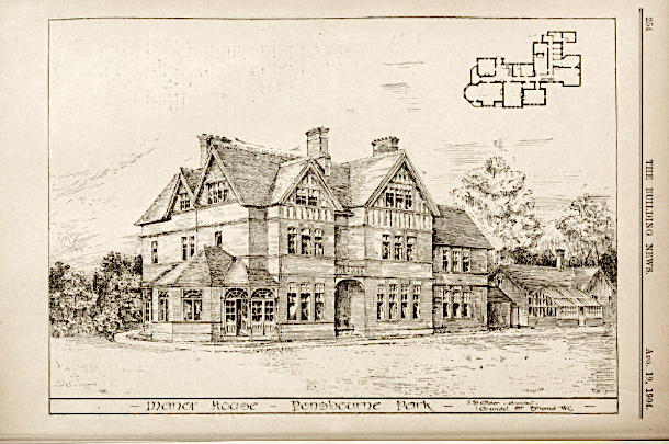 Architectural drawing of the Manor House, Ponsbourne Park, England (UK)
 Footpath near Peter's Green, Hertfordshire
 Target Dossier for Hatfield Hyde, Hertfordshire, England - DPLA - 5a7a6615c8ddae229e7111e7fba26146 (page 1)
 Target Dossier for Hatfield Hyde, Hertfordshire, England - DPLA - 5a7a6615c8ddae229e7111e7fba26146 (page 2)
 Hertfordshire: Robert Morden (1695)
 Industrial Building at Water End
 Retaining wall to Railways on B653
 Shelvokes 3
- Speculum Britanniae: Hartfordshire - 1597 work by John Norden, English
- A Decorated Iron Age Copper Alloy Knife from Hertfordshire - , Q1860, 1999
| Type | Subtype | Date | Description | Notes | Source |
|---|---|---|---|---|---|
| commons | image | Track through Wall Wood, Hertfordshire | Commons | ||
| commons | image | The Golden Light Of Autumn Forest (127228175) | Commons | ||
| commons | image | Architectural drawing of the Manor House, Ponsbourne Park, England (UK) | Commons | ||
| commons | image | Footpath near Peter's Green, Hertfordshire | Commons | ||
| commons | image | Target Dossier for Hatfield Hyde, Hertfordshire, England - DPLA - 5a7a6615c8ddae229e7111e7fba26146 (page 1) | Commons | ||
| commons | image | Target Dossier for Hatfield Hyde, Hertfordshire, England - DPLA - 5a7a6615c8ddae229e7111e7fba26146 (page 2) | Commons | ||
| commons | image | Hertfordshire: Robert Morden (1695) | Commons | ||
| commons | image | Industrial Building at Water End | Commons | ||
| commons | image | Retaining wall to Railways on B653 | Commons | ||
| commons | image | Shelvokes 3 | Commons | ||
.jpeg)
.jpg)
.jpg)