Old Railway Station Portadown - geograph.org.uk - 2347044.jpg
From WhereToday
No higher resolution available.
Old_Railway_Station_Portadown_-_geograph.org.uk_-_2347044.jpg (640 × 415 pixels, file size: 71 KB, MIME type: image/jpeg)
Summary
| Description |
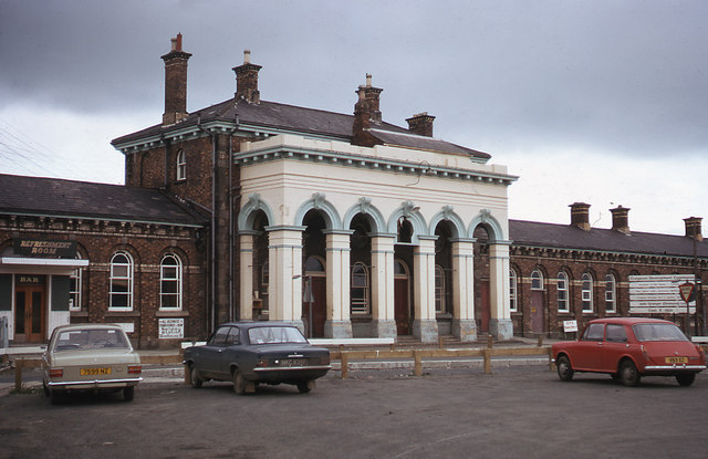
English: Old Railway Station Portadown Portadown's third railway station was built 1861-2 to a design by Sir John Macneill. It closed in October 1970 and was quickly demolished as it was in the path of a new road linking Portadown with Lurgan. |
| Date | |
| Source | From geograph.org.uk |
| Author | The Carlisle Kid |
| Permission (Reusing this file) |
Creative Commons Attribution Share-alike license 2.0 |
| Attribution (required by the licence) | The Carlisle Kid / Old Railway Station Portadown / |
| Camera location | | View this and other nearby images on: OpenStreetMap |
|---|
_heading:22.00&language=en-gb)
| Object location | | View this and other nearby images on: OpenStreetMap |
|---|
_heading:22.00&language=en-gb)
Licensing

|
This image was taken from the Geograph GB & Eire project collection. See this photograph's page on the Geograph website for the photographer's contact details. The copyright on this image is owned by The Carlisle Kid, and is licensed for reuse under the Creative Commons Attribution Share-Alike 2.0 license.
|
This file is licensed under the Creative Commons Attribution-Share Alike 2.0 Generic licence.
Attribution:
The Carlisle Kid
- You are free:
- to share – to copy, distribute and transmit the work
- to remix – to adapt the work
- Under the following conditions:
- attribution – You must give appropriate credit, provide a link to the licence, and indicate if changes were made. You may do so in any reasonable manner, but not in any way that suggests the licensor endorses you or your use.
- share alike – If you remix, transform, or build upon the material, you must distribute your contributions under the same or compatible licence as the original.
File history
Click on a date/time to view the file as it appeared at that time.
| Date/Time | Thumbnail | Dimensions | User | Comment | |
|---|---|---|---|---|---|
| current | 08:28, 17 July 2021 | | 640 × 415 (71 KB) | wikimediacommons>GeographBot | Uploading geograph.org.uk image from https://www.geograph.org.uk/photo/2347044 |
File usage
There are no pages that use this file.