Loco at the Dales Countryside Museum (geograph 6358983).jpg
From WhereToday
File:Loco at the Dales Countryside Museum (geograph 6358983).jpg

Size of this preview: 800 × 600 pixels. Other resolutions: 320 × 240 pixels | 640 × 480 pixels | 1,024 × 768 pixels | 1,280 × 960 pixels | 2,560 × 1,920 pixels | 4,000 × 3,000 pixels.
Original file (4,000 × 3,000 pixels, file size: 2.86 MB, MIME type: image/jpeg)
.jpg)
Summary
| Description |
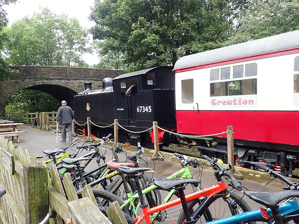
English: Loco at the Dales Countryside Museum On the site of the former Hawes Station, the loco is part of the museum and its carriage is used for craft sessions. |
| Date | |
| Source | From geograph.org.uk |
| Author | Eirian Evans |
| Permission (Reusing this file) |
Creative Commons Attribution Share-alike license 2.0 |
| Attribution (required by the licence) | Eirian Evans / Loco at the Dales Countryside Museum / |
| Camera location | | View this and other nearby images on: OpenStreetMap |
|---|
.jpg¶ms=054.304462_N_-002.192060_E_globe:Earth_type:camera_source:geograph-osgb36(SD87608989)_heading:292.00&language=en-gb)
| Object location | | View this and other nearby images on: OpenStreetMap |
|---|
.jpg¶ms=054.304640_N_-002.192980_E_globe:Earth_class:object_type:object_source:geograph-osgb36(SD87548991)_heading:292.00&language=en-gb)
Licensing

|
This image was taken from the Geograph GB & Eire project collection. See this photograph's page on the Geograph website for the photographer's contact details. The copyright on this image is owned by Eirian Evans, and is licensed for reuse under the Creative Commons Attribution Share-Alike 2.0 license.
|
This file is licensed under the Creative Commons Attribution-Share Alike 2.0 Generic licence.
Attribution: Eirian Evans
- You are free:
- to share – to copy, distribute and transmit the work
- to remix – to adapt the work
- Under the following conditions:
- attribution – You must give appropriate credit, provide a link to the licence, and indicate if changes were made. You may do so in any reasonable manner, but not in any way that suggests the licensor endorses you or your use.
- share alike – If you remix, transform, or build upon the material, you must distribute your contributions under the same or compatible licence as the original.
File history
Click on a date/time to view the file as it appeared at that time.
| Date/Time | Thumbnail | Dimensions | User | Comment | |
|---|---|---|---|---|---|
| current | 17:49, 6 November 2020 | | 4,000 × 3,000 (2.86 MB) | wikimediacommons>Lamberhurst | Transferred from geograph.co.uk using [https://tools.wmflabs.org/geograph2commons/ geograph2commons] |
File usage
There are no pages that use this file.
.jpg)