Bridge at Smithills Hall - geograph.org.uk - 116124.jpg
From WhereToday
No higher resolution available.
Bridge_at_Smithills_Hall_-_geograph.org.uk_-_116124.jpg (640 × 480 pixels, file size: 162 KB, MIME type: image/jpeg)
Summary
| Description |
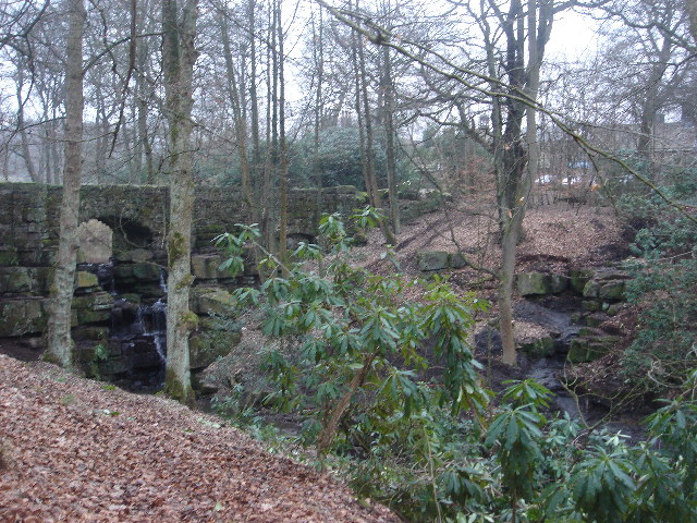
English: Bridge at Smithills Hall. Smithills Coaching house can be seen through the trees. It is now a restaurant but used to be the coach house for the Hall. This is one end of the Raveden Brook nature trail - a lot of clearing up , pruning of bushes and path-laying is being done. |
| Date | |
| Source | From geograph.org.uk |
| Author | Margaret Clough |
| Attribution (required by the licence) | Margaret Clough / Bridge at Smithills Hall / |
| Object location | | View this and other nearby images on: OpenStreetMap |
|---|
_&language=en-gb)
Licensing

|
This image was taken from the Geograph GB & Eire project collection. See this photograph's page on the Geograph website for the photographer's contact details. The copyright on this image is owned by Margaret Clough, and is licensed for reuse under the Creative Commons Attribution Share-Alike 2.0 license.
|
This file is licensed under the Creative Commons Attribution-Share Alike 2.0 Generic licence.
Attribution:
Margaret Clough
- You are free:
- to share – to copy, distribute and transmit the work
- to remix – to adapt the work
- Under the following conditions:
- attribution – You must give appropriate credit, provide a link to the licence, and indicate if changes were made. You may do so in any reasonable manner, but not in any way that suggests the licensor endorses you or your use.
- share alike – If you remix, transform, or build upon the material, you must distribute your contributions under the same or compatible licence as the original.
File history
Click on a date/time to view the file as it appeared at that time.
| Date/Time | Thumbnail | Dimensions | User | Comment | |
|---|---|---|---|---|---|
| current | 00:47, 31 January 2010 | | 640 × 480 (162 KB) | wikimediacommons>GeographBot | == {{int:filedesc}} == {{Information |description={{en|1=Bridge at Smithills Hall. Smithills Coaching house can be seen through the trees. It is now a restaurant but used to be the coach house for the Hall. This is one end of the Raveden Brook nature trai |
File usage
There are no pages that use this file.